Services
Our services include taking/collecting high-resolution photos, videos and data, with great speed, accuracy and security, pre-estimating the conditions of a project and designing it (even in hard-to-reach areas), the management and monitoring (supervision) of a project in every phase of its implementation, the management of the progress of the work, the documentation of the field work and its final acceptance.
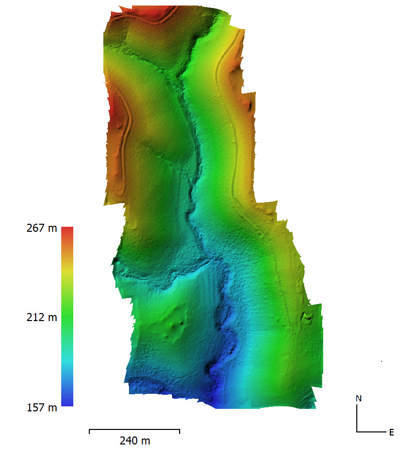
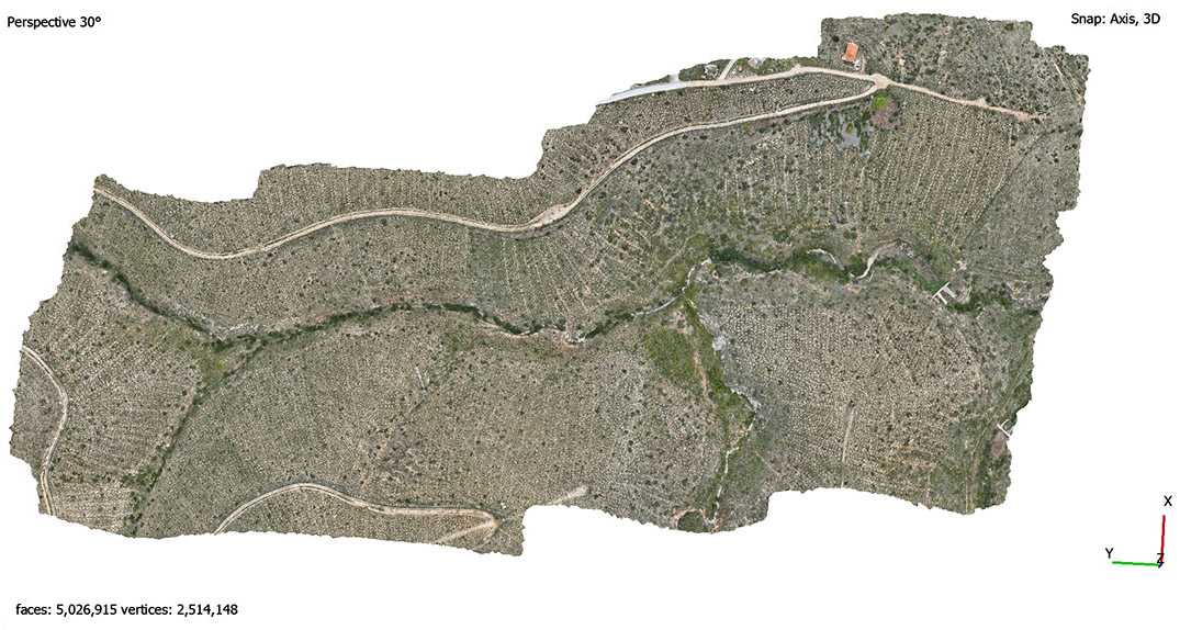
The creation of maps and 3D models of a project helps to make the right strategic decisions. At the end of each inspection, our company is able to draw up the final report and provide it to the customer after the necessary processing of the photos and other data in the specialized software that our company has access to. Finally, we can provide chronological presentation of all construction phases of a project, through impressive images and 4K video production.
Cadastral Data – Photo Interpretation
Our company can examine and record the current shape of land of cadastral interest and land uses, via Drone. With aerial mapping we can take accurate measurements of plots and properties and determine their exact boundaries and topography, and identify vegetation as well as structures, roads and paths. In this way, we can produce orthophoto maps and 3D models of exceptional accuracy and evaluate and utilize the qualitative information that will be produced for the shape of each area, for photointerpretive purposes.
All works carried out by our company in the field, for scientific and research programs, is always done with the aim of protecting the environment, so that the habitat and species of flora and fauna are not affected in the least.
In order to visualize the result as well as the difficulty of each project, it is necessary to study the area in comparison with its older form, through aerial photography and videography of the project in all phases of its construction, via Drone.
The use of modern unmanned aircraft (Drone) and other equipment as well as the appropriate selection and purchase of software is initially addressed to the necessity of reducing costs and time, in project supervision and inspection services.
The company il Verde has many years of experience, with specialized employees in public and private green projects as well as forestry projects and by using the relevant technology, has managed to implement and to develop, new more effective methods and thus is now able to offer a wide range of aerial inspection services related to the sector of the Environment, according to the client’s requirements.